Projects
Sentinel observatory
Long term interdisciplinary research device aiming to study spatial and temporal dynamics of mountain ecosystems.
Start date: 01/01/2020
 Benjamin Komac
 Clara Pladevall
 Manel Niell
 Meritxell Martin
 Roger Caritg
Work strands:
Global change
Flora
Mapping
Fauna
Ecology and biodiversity
Climate
Flora
Mapping
Fauna
Ecology and biodiversity
Climate
Financing program:
Internal
Mountain areas are ideal places to study the impact of climate change on ecosystems because there are strong thermal variations over short distances. Altitude gradients are the most optimal places for natural experiments to evaluate and measure the ecological responses of fauna and flora in the face of geophysical influences. This motivated the Zone Atelier Alpes (ZAA, —interdisciplinary long-term research device, LTER— on the environment and human-environment interactions, piloted by the CNRS) to launch the Sentinelles des Alpes project in 2015, a project with five devices for observing the climate-biodiversity-man relationship. This project aims to standardize methodologies, enhance production (knowledge, management tools) and pool resources. One of these devices is called ORCHAMP and aims to study in the long term, in an altitudinal gradient, the spatial and temporal dynamics of mountain ecosystems. At Andorra Research + Innovation we wanted to apply the ORCHAMP device in Andorra under the name of Sentinel Observatory.
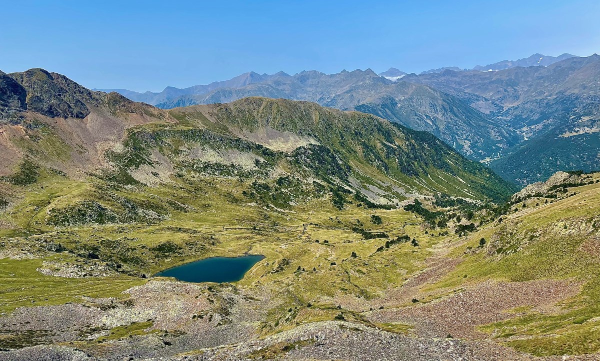
The area chosen for this study in Andorra is the Estanyó valley, in the Vall de Sorteny Natural Park. This valley has a significant drop (1.200 m), which allows the installation of several sampling plots, which must be separated by about 200 m. The original ORCHAMP protocol —developed by the LECA of Grenoble— consists of using and adapting existing protocols, such as the GLORIA protocol for flora, the Teabag protocol for soil decomposition, the RMQS protocol for INRA soils or the forestry protocol PSDRF (ENGREF-ONF). The original protocol defines a number of follow-ups to be performed, but then follow-ups can be added according to the competencies of the entities participating in each follow-up point. This highlights the fact that it is a participatory follow-up: in other words, the participating entities contribute their knowledge and skills to the entire ORCHAMP program in general.
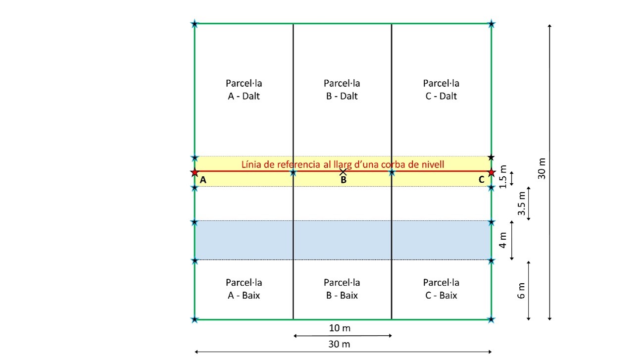
The monitoring is based on the installation of permanent monitoring plots of 900 m2 (30 x 30 m). A plot is divided into three sections (A, B and C) six subplots (top to bottom), three above and three below the reference level curve. The general organization of a plot is as follows:
During 2020, five plots have been installed and marked along the altitudinal gradient in the Estanyó valley and the first forest, flora and vegetation inventories and decomposition of organic matter have been carried out, in addition to installing two dendrometers on the three lowest plots. Other studies will be launched in the coming years, such as soil analysis with a pedological profile.
Some follow-ups will be done annually, others every three, five or seven years. This long-term and multidisciplinary observatory is open to all research actors —academic or non-academic— around a common goal: to better understand in time and space the dynamics coupled between climate, land use and the biodiversity of mountain ecosystems.
[1] IPCC "Cambio climático 2014: Informe de síntesis. Contribución de los Grupos de trabajo I, II y III al Quinto Informe de Evaluación del Grupo Intergubernamental de Expertos sobre el Cambio Climático" 2014. [Equip principal de redacció, R.K. Pachauri i L.A. Meyer (eds.)]. Ginebra, Suiza, 157 p.