Projects
Sentinel lakes
Studies of lakes to increase knowledge on their ecological functioning,identify threatening factors and define management actions to preserve them.
Start date: 01/01/2017
Team:
 Benjamin Komac
Benjamin Komac
Work strands:
Global change
Ecology and biodiversity
Climate
Ecology and biodiversity
Climate
Financing program:
Internal
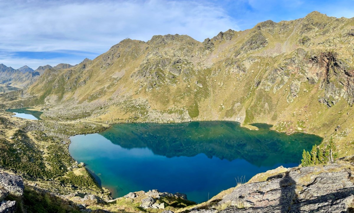
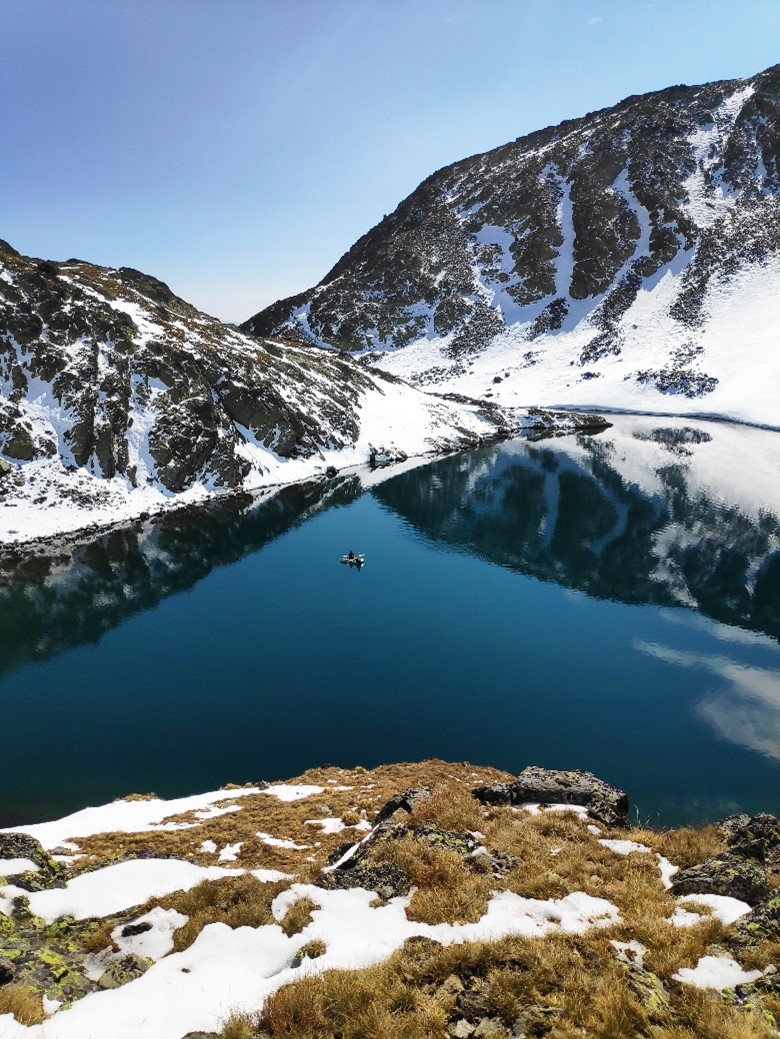
Lakes are representative elements of the Pyrenean landscape. They are located at the headwaters of basins, often having an image of a virgin nature, usually attributed by distance to sources of pollution.
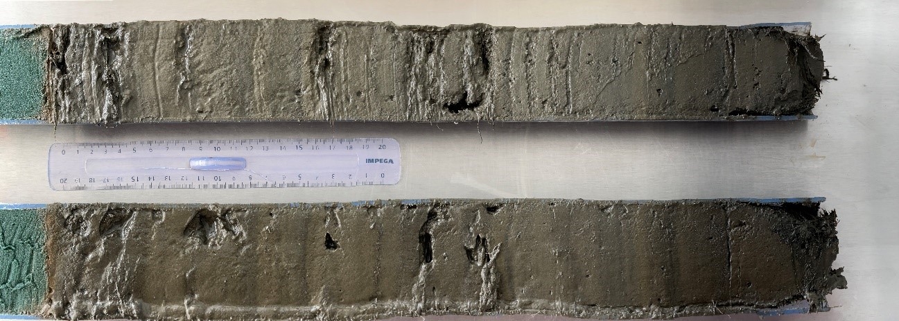
Recent studies have shown that these ecosystems are highly sensitive to climate change, environmental change, and anthropogenic pressure. One of the characteristics of the lakes is that all the general changes in the environment are recorded through the sediments that accumulate there year after year. Sediments are like books that tell, in a more or less complex way, the history of climate, environment and ecosystems over thousands of years. The task of the scientist is to know how to interpret them. Therefore, ponds are ideal places to find indicators that measure impacts on ecosystems and measure the speed of change at different time scales.
The monitoring of mountain lakes began in 2017 with the project POCTEFA REPLIM (acronym for REd PaleoLIMnológica de lagos y turberas) and is now a consolidated research project. The study of lakes has two objectives: to detect and determine the climatic variations that took place during the last millennium (or more) from the interpretation of sediments and to improve knowledge about the current ecological functioning of lakes.
As part of this project, Andorra Research + Innovation has the collaboration of the GEODE laboratory (Geographie de l’Environnement) of the University of Toulouse Jean Jaurès and the Institut Pirenaico de Ecología de Zaragoza.
After the study of the lakes of Montmalús and Estanyó, started in the summer of 2017, in 2020 we have begun to study the lakes of Tristaina (the lake of Més Amunt), the Forcat and Negre (the latter two in the Valls del Comapedrosa Communal Natural Park). In addition to taking sediment samples, the physico-chemical parameters of the water (temperature, pH, conductivity, oxygen ...) are monitored. Permanent temperature sensors at different depths have been installed in each lake, which continuously monitor the water temperature. These lakes are deep enough that, at certain times, the water no longer mixes up and down and is stratified by temperature. The water has a maximum density of 4 °C and this cold water tends to remain at the bottom of the pond, while warmer (or colder) water tends to rise to the surface. Seasonal alternation of periods of stratification and thermal mixing has important consequences for the biological life of the lake. When mixing begins, the rising water is poor in oxygen and rich in nutrients. Therefore, we may have sudden increases in the amounts of planktonic algae at that time, and in particular, if the lake is polluted, a deprivation of oxygen that can endanger fish. During the sampling, it is also used to measure the depth of the lake with an echo sounder, in order to have a bathymetric map of the bottom of the lakes.
With the results of the first years of monitoring, future indicators of climate and / or anthropogenic change will be established to document the impacts of climate change in mountain areas. At the same time, they will be useful to public administrations. This monitoring as a whole should make it possible to identify the threats that exist on these lakes —in particular those related to global changes— in order to define, in the long term, the management actions that must be carried out in these environments. in order to better preserve them.