Projects
MONTCLIMA
Transnational strategic framework on natural risk prevention and management in mountain regions.
Start date: 06/01/2019
End Date: 12/03/2022
 Anna Echeverria
 Benjamin Komac
 Marc Font
Work strands:
Global change
Natural risks
Natural risks
Financing program:
Interreg Sudoe
The MONTCLIMA project is a territorial cooperation programme for the European Southwest Area (SUDOE) which supports regional development by co-financing transnational projects through European regional development funds (ERDF). The MONCLIMA project focuses on the study and prevention of natural risks in mountain areas of SUDOE territory.
Mountain areas are among the areas most affected by natural risks and these risks are expected to increase due to the effects of climate change (more severe droughts, higher average temperatures, changes in the precipitation regime). These risks know no administrative limits (e.g., fires that cross borders of continuous forest masses) and need transnational coordination. In addition, the SUDOE space is one of the areas in the world that suffers most and will suffer from the effects of climate change (IPCC 2014). By strengthening a risk-based approach regarding climate change, the project is in line with international agreements such as the Sendai Framework for the Reduction of the Disaster Risk from the United Nations and the Paris Agreement on Climate Change. The MONTCLIMA project will develop the first transnational strategic framework for the prevention and management of natural risks in mountain areas for the SUDOE territory.
The project has four strategic objectives:
- Capitalize successful cases of forms of governance and practical initiatives to prevent and manage natural risks. All this will be done by conducting a study on the current state of internships with a transnational approach in the SUDOE area; the analysis of the past, present, and future vulnerability of these mountain territories through a web application that highlights the information on past and future vulnerability to the four object risks and that improves the management and technical analysis and legal risk management in the study area.
- Design a methodology for drawing up a transnational strategic framework for the prevention and management of risks in SUDOE mountain areas. It is intended to obtain a framework document that integrates operational and strategic recommendations for each axis, in accordance with the results obtained at the previous point and applicable to the mountain areas of the SUDOE area. The document will take account of the mountain regions specificities of the SUDOE from the experiences and knowledge of the project's partners and associates. Finally, this Transnational Strategic Framework will be enriched with the knowledge acquired through the pilot cases of the project, so that it can be contrasted on the ground with practical cases and at different stages of implementation.
- Test the transnational strategic framework in SUDOE territories for the risks mentioned through pilot trials.
- Communication and dissemination of results and tools with a special focus on the transfer and replicability of results to key actors in the design and implementation of natural risk prevention and management policies of the SUDOE territories. For this purpose, a series of specific measures are proposed which are mainly reflected through thematic seminars and ground visits to pilot cases.
One of the SUDOE MONTCLIMA project key actions is design and implementation (proof and development) of common action plans for prevention and management of natural risks, which will be validated or improved by pilot testing.
Two of these pilot tests, run by FORESPIR and ANDORRA Research + Innovation, are being carried out in the Principality of Andorra (Pyrenees). The Andorran territory is a mountainous territory (the average altitude of the Principality is 2048 m) with large and strong slopes where natural risks are multiple. In Andorra, forests occupy more than 40% of the territory and play an important role in preventing risks such as block falls, snow avalanches, turret lavas... Therefore, the development of mitigation strategies is very important and can be carried out through the study and analysis of natural disasters, but also through impact assessment. In Andorra, as in many mountain areas, mitigation strategies are subject to a multi-risk approach to actions, since, for example, a forest protection against the fall in blocks is also at risk of fire. For these reasons, it is important to consider both the protective function and the vulnerability of forests to prevent risk mitigation action from being more favourable to other risks.
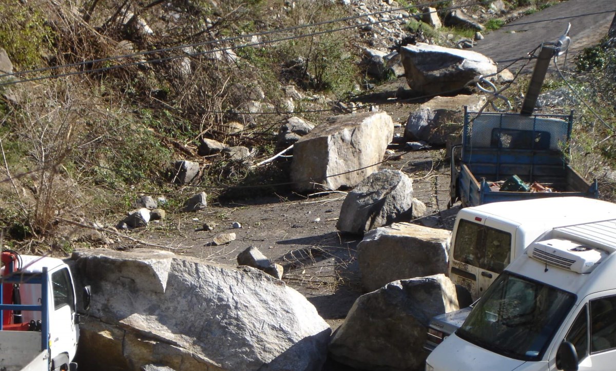
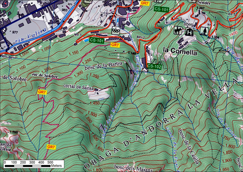
The first pilot tests carried out in Andorra focus on the risk of falling blocks, but they also consider the fire risk, as climate change will increase frequency and severity. More specifically, the action envisages acting in a protective forest against the fall of blocks located in the parish of Andorra la Vella in the Comella area, very close to major urban areas. In this protective forest against the fall of blocks, located near a recreational area and where the likelihood of starting a forest fire is greater, it is intended to reduce the risk of forest fire and, if produced, reduce the intensity, and allow the forest to retain its protective role.
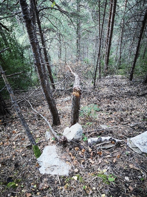
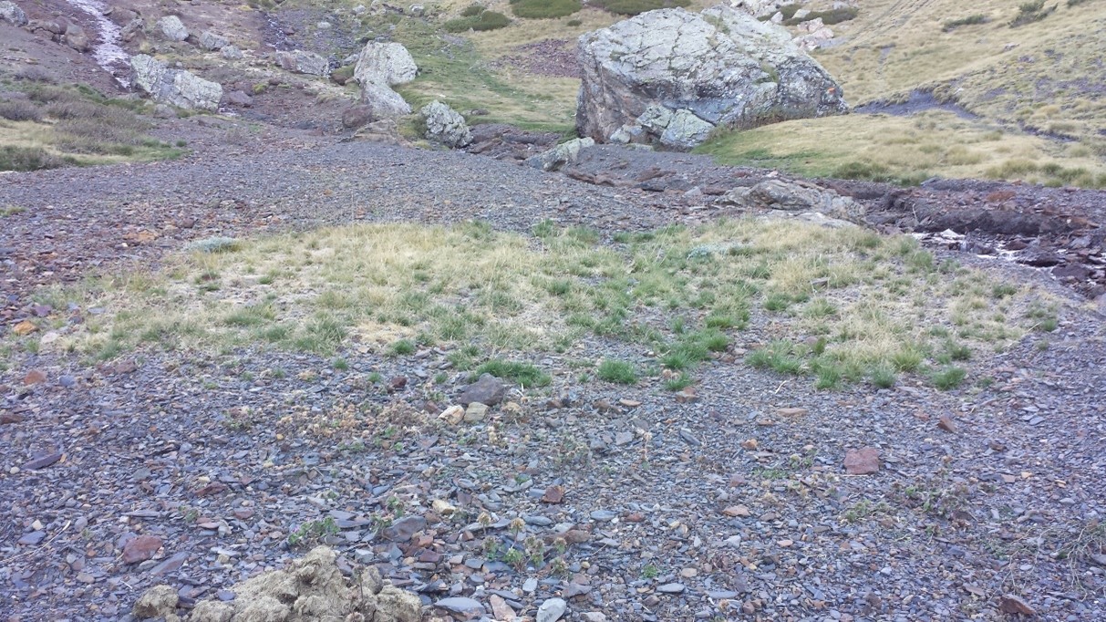
The second pilot test carried out in Andorra focuses on floods and torrential floods risk in the calm area of Camp de Claror, in the Madriu-Perafita-Claror valley, where large areas of forests and meadow vegetation are scarce. In this area, scree, and rocky areas with some patches of sparse vegetation predominate (as in many other areas of the territory). Stone blocks are usually more mobile and erodible, and the consequences can be significant and affect the person directly or indirectly. This happened on July 21, 2015, when a large stationary convection storm in the Camp of Claror area accumulated 71 l / m2 in one hour and up to 96 l / m2 during the 24 hours associated with the episode. Due to this high intensity of precipitation, there was surface runoff on steep slopes of sparse vegetation, which led to intense erosive phenomena at the headwaters of several mountain rivers. In the Claror River basin, torrential avenues were deposited at the foot of the slope, but due to sediment deposition the Claror River regained its erosive potential downstream. All this caused a strong turbidity of the river and made the waters of the parish of Escaldes-Engordany, which has the deposit of drinking water below, in the same basin, unfit for human consumption. The new, much less intense rains that occurred during the summer generated new erosive episodes and caused further cuts in the water supply. It was then necessary to consolidate the sediments accumulated in the area and stop the erosive process at the headwaters of the Claror River, with the aim of reducing the magnitude and frequency of subsequent erosive episodes.
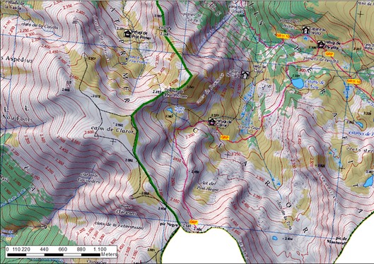
As the area is part of a world heritage cultural landscape for UNESCO, anthropic interventions must be minimal and always respect the natural environment, the landscape without damaging natural resources. Between 2015 and 2017 restoration actions were carried out to stabilize sediments and prevent further movement of solid materials. The goal was achieved, but now, after a few years, it is necessary to complete the work done to perpetuate the actions and this is what is intended to be done within the framework of the MONTCLIMA project. More specifically, the action envisages focusing on the revegetation work carried out especially in 2016 and carrying out fertilization and completing revegetation with new plantations at some specific points.
Project with SUDOE funding. The leader of the project is the Pyrenean Climate Change Observatory of the Consortium of the Pyrenees Working Community. The project partners are Centro de Investigacion Ecologica y Appciones Forestales, NEIKER-Instituto Vasco de Investigación y Desarrollo Agrario, Fundacion Centro de Servicios y Promocion Forestal y de su Industria de Castilla, Instituto Politécnico de Bragança, Office National des Forêts, FORESPIR, Centre d'Études et d'Expertise sur les Risques, l'Environnement, la Mobilité et l'Aménagement, Comunidade Intermunicipal da Regiao de Leiria.