Projects
MOMPA
Monitoring of Land Movements and Action Protocol.
Start date: 01/12/2019
End Date: 30/06/2022
Team:
 Anna Echeverria
 Laura Trapero
Anna Echeverria
Laura Trapero
Work strands:
Natural risks
Geology
Geology
Financing program:
Interreg POCTEFA
It is a European project that aims to monitor deformations related to geological hazards due to land movements as a fundamental action for prevention in highly anthropogenic areas.
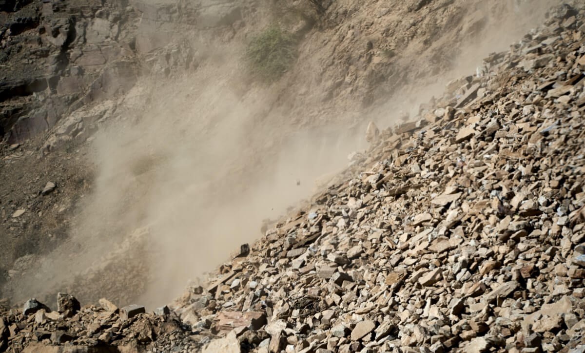
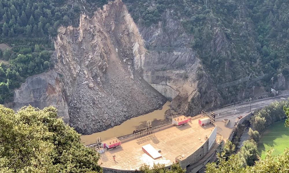
The project draws up instability maps to continuously assess the potential impact on the most vulnerable elements. In areas that are detected as most sensitive due to their high risk, thresholds will be established, and action protocols will be defined for civil protection. The aim is to improve the capacity of anticipation and response of local actors to specific risks and the management of natural disasters. An example is the landslide of the Portalada d’Andorra.
The overall goal of the MOMPA is to proactively manage ground movement risk, including aspects of risk prevention and management. The innovative element of the project is the use of remote sensing, in particular, the technique of interferometry SAR (inSAR), based on satellite images, for ground movements detection. This technique is sensitive to very small deformations of the ground, which favours a rapid detection of movements.
Project objectives:
- Land movement monitoring maps in areas of Alt Urgell, Cerdanya, Capcir, Conflent and Andorra.
- Maps of instabilities by means of cartographic delimitation of the movement zones
- Risk assessment of the elements exposed to the identified ground movements.
- Definition of action protocols in support of civil protection actions.
To achieve the above objectives, a series of actions have been defined:
- Action 1: Coordination of all technical activities and communication between partners to ensure the project’s optimal execution.
- Action 2: Communication activities.
- Action 3: Monitoring terrain movements.
- Action 4: Risk analysis associated to terrain movements.
- Action 5: Action protocol
The communication activities of action 2 are currently focused on the project’s scientific dissemination and the first results. During 2021, if the health crisis allows it, participation is planned in different congresses, among them in the General Assembly of the EGU (European Geoscience Union), the EUROCK2021 in Italy, the X National Symposium of Unstable Slopes and Slopes and the X Geological Congress of Spain.
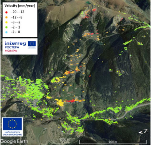
Within the framework of action 3 — monitoring of land movements— the regional mapping of land displacement identification has been completed, which has made it possible to identify the Active Deformation Areas (ADA) in the project work area (4,000 km2). At the local level, for the Andorran territory, after validating the spatial coherence of these areas with the slope movements identified by the Government of Andorra, we have proceeded to select the ADA with more interest to carry out the analyses of susceptibility and risk associated with these movements. The total area of the 218 ADAs identified in Andorran territory represents 3 km2 (<1% of the territory), of which 34% are classified as dangerous landslides. The four areas selected to work on actions 4 and 5 of the project (“Analysis of the risk associated with the movement and action protocol”) are in the Ransol valley, in the Forn de Canillo, in the Anyós area and the Portal to Sant Julià de Lòria.
The first results, obtained with images from the Sentinel-1 satellite —where terrain deformations are detected in the Forn de Canillo — are an example of a result produced in a slope movement near an urban centre.
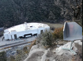
On the other hand, in the case of the Portalada study, due to the complexity of the area, with a very steep and wooded area, eight passive and one active reflector have been installed to guarantee the monitoring and characterization of the current movement of the terrain. The corner-reflectors´ mission is to encourage the reflection of radar waves sent by the satellite in order measure more accurately the deformations of the terrain in the area. The installation and the first results have been verified during the beginning of this year. The goal is to explore the integration of satellite data into existing risk prevention protocols at this site.
It is a European project co-financed 65% by the European Regional Development Fund (ERDF) in the framework of the Interreg V-A Spain-France-Andorra Program (POCTEFA) 2014-2020.