Projects
BOSPIR-3D
Multi-objective quantification of Pyrenean forests using laser scanning techniques.
Start date: 01/11/2025
End Date: 31/10/2028
 Oriol Travesset
 Ian Serra
 Ot Pasques
Work strands:
Remote sensing
Forest resources
Forest resources
Financing program:
Interreg POCTEFA
Close-range scanning technologies, artificial intelligence, and virtual reality are transforming the way forest ecosystems are characterized and analyzed. Accurate quantification of forest resources is essential both for the timber industry and for designing multifunctional management plans that consider biodiversity conservation, wildfire prevention, and carbon sequestration.
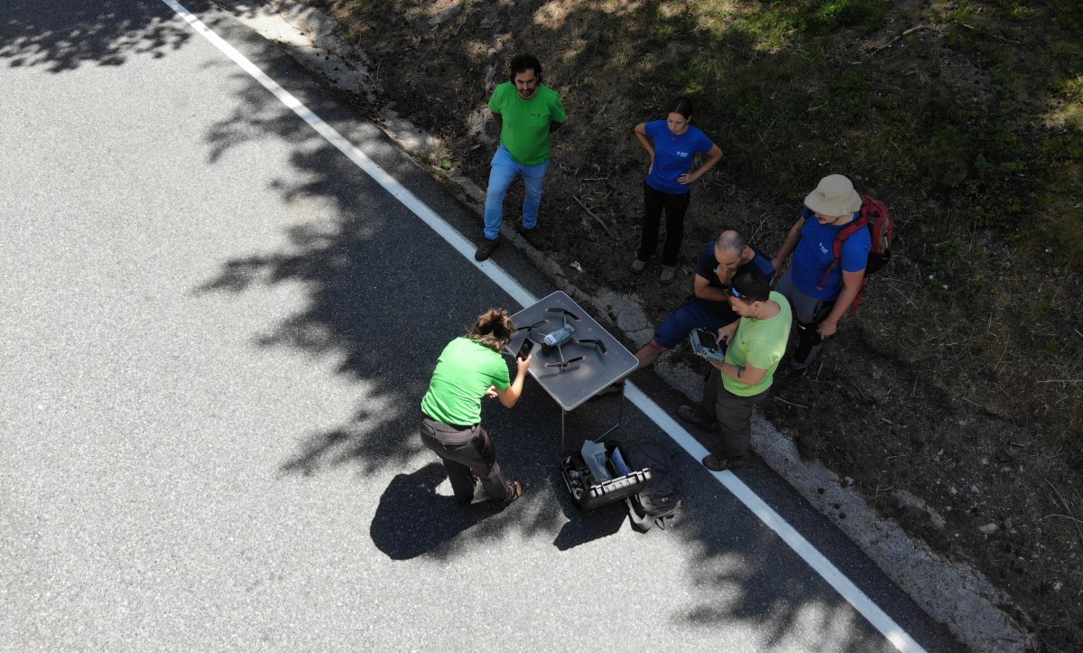
Traditional forest inventory methods are highly labor-intensive, requiring technicians to physically access plots and manually measure variables such as tree diameter and height. These methods, in addition to being costly and slow, can be inaccurate, particularly in areas that are difficult to access.
Laser scanning technologies are revolutionizing forest resource monitoring by offering greater efficiency, recurrence, and precision, as well as a much larger volume of information (e.g., vegetation structure). Nevertheless, it is necessary to assess data quality, operational applicability, and economic feasibility.
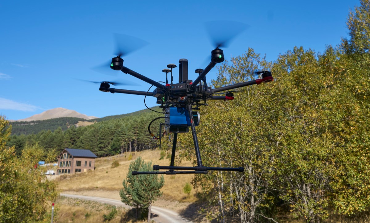
The project aims to develop innovative methodologies that integrate multiple close-range sensors, including terrestrial laser scanning (TLS/MLS) and UAV-based LiDAR, to generate three-dimensional (3D) point-cloud models of Pyrenean forests. BOSPIR-3D will evaluate the reliability and viability of these digital technologies at an operational scale.
The resulting high-resolution description of forest structures will support decision-making systems to improve forest management plans. Thus, a key objective of the project is to facilitate knowledge transfer to local organizations, promoting methodological harmonization among stakeholders across borders through workshops and capacity-building activities.
In Andorra, the project focuses its activities on the development of a specific case study designed to test digital protocols under high-mountain conditions and in forests with complex structural characteristics. AR+I leads this case, coordinating the selection of the pilot site, where conventional forest inventories and advanced data acquisition using UAV-LiDAR, hyperspectral sensors, and terrestrial TLS/SLAM scanners will be conducted. In addition, Andorra will serve as a key hub for knowledge transfer, organizing workshops, seminars, and training courses targeted at forest technicians, public administrations, and other local stakeholders, ensuring that the new technologies developed can be integrated into the country’s forest management policies and practices.